Services
Civil Engineering
Surveying
Site Planning
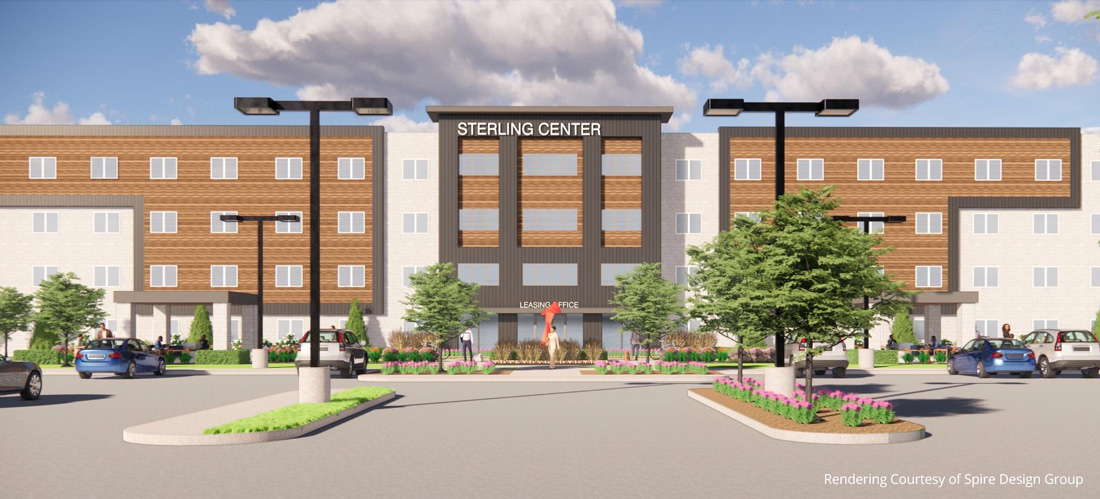
Sterling Heights, Michigan

Phase 1
Giffels Webster worked with the owner and architect on the engineering of a 91 unit Apartment complex utilizing the existing foundations and infrastructure from a former Knights Inn hotel. Giffels Webster worked with a concept and site plan that was previously approved through the City and was able to find additional parking and space for a maintenance garage/office for the development. As a part of Giffels Webster’s design, they also considered the owners desire to develop a second phase on the property to the south of this development so that future connections would be feasible.
Giffels Webster reviewed the existing infrastructure and was able to maintain most of the underground while adding in additional utility leads for new buildings and maintaining the finish floor of the buildings while still bringing the parking lot grading into modern compliance. Giffels Webster played an integral part in the Site Plan Amendment process, performed a topographic and boundary survey, prepared engineering drawings for use in permitting, prepared easement documents for the proposed utilities as well as vacated several old easements that were under existing buildings, performed construction administration, construction layout, foundation grade certification, and as-built drawings for the development once under construction.
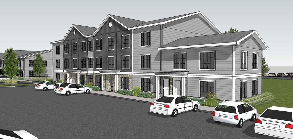
Phase 2
Giffels Webster worked with the owner and architect on the planning and engineering of a 110 unit apartment complex that would closely resemble the first phase of the development. Giffels Webster reworked the site plan that was previously approved through the City as it was noted that the county drain running through the site could not be relocated as previously planned. Giffels Webster worked with the owner and architect on a new three-story version as well as the addition of a few of the two story building types from the first phase in order to maintain the 110 unit goal of the developer. As a part of Giffels Webster’s design, they took what was a clogged drainage ditch and turned it into an open space amenity with a small creek running through it while minimizing the impacts and avoiding a major EGLE permit. Giffels Webster once again considered the owners desire to develop a future phase to the south and west of this development so that there would be minimal disruption to the current phase if that were to happen.
The portion of the union drain that was preserved as part of this project was recently published in the counties annual calendar as “What to do” when improving county drains. During construction, Giffels Webster was also tasked with adding an additional maintenance garage which was added into the southwest corner of the development and reworked several of the underground utility locations within this area as the contractor was in the midst of construction during this design.
Giffels Webster played an integral part in the site plan amendment process, performed a topographic and boundary survey, prepared engineering drawings for use in permitting, obtained county and state permits for the additional drain work, prepared easement document for the proposed utilities as well as new easement for the drain work, performed construction administration, construction layout, foundation grade certification, and as-built drawings for the development.