Technology is enhancing the process of traditional surveying and providing planners and designers more data than ever before. With 3D laser scanners, surveyors collect significantly more data but do so in half the time. When partnered with drone mapping technology, the final images produced have life-like detail and precise measurements. This technology provides a more in-depth picture and can be used in a variety of industries including construction, manufacturing, surveying and engineering.
Recognizing the advantages of a more comprehensive picture, Giffels Webster integrates 3D laser scanning and drone mapping in a collective surveying suite. Utilizing this industry-leading technology allows our surveyors to map and model complex sites with an unprecedented level of detail, speed and accuracy.
How Does It Work?
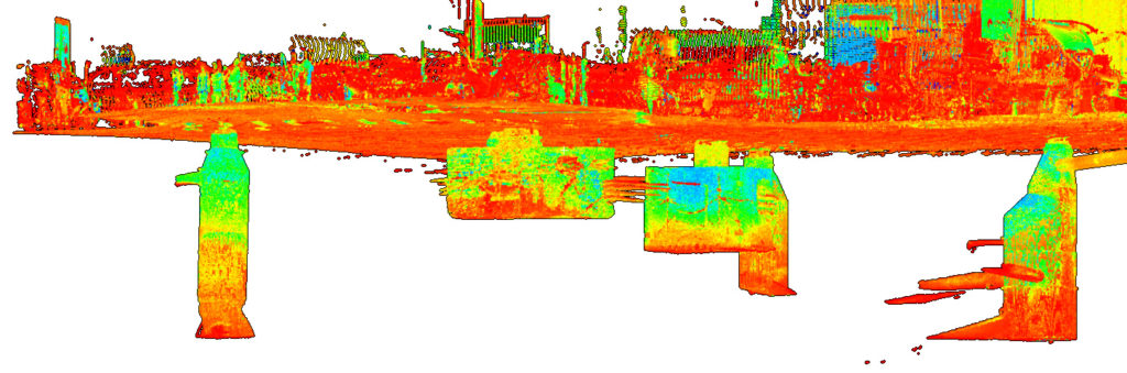
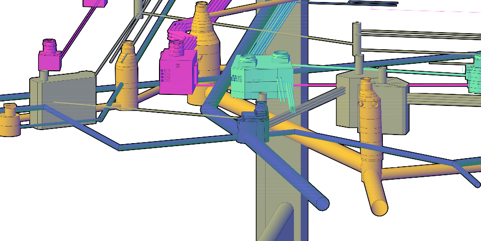
3D laser scanners collect millions of data points from the surface of a project site to form a dense 3D point cloud. This digital “cloud” of geometrical data points is pieced together to create a 360° view of construction sites, buildings and plots of land that are extremely precise and accurate. Drone mapping provides high-resolution aerial images that licensed surveyors pair with scanning data to ultimately produce a comprehensive picture for planning and design.
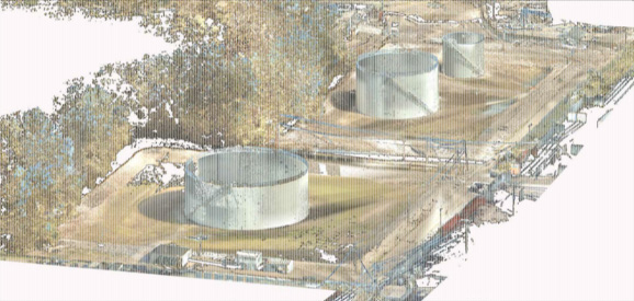
This image of a refinery in Romulus was created using a Leica 3D laser scanner.
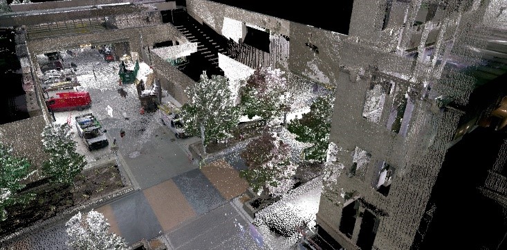
This image of the DTE Campus in Downtown Detroit was created using a Leica 3D laser scanner.
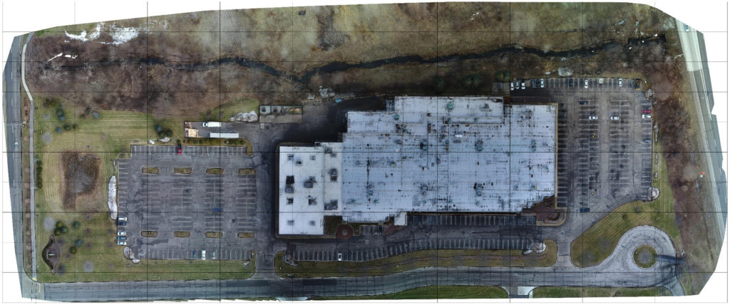
This image of an industrial building in Auburn Hills was created using a DJI Inspire 2 drone.
The Benefits: New Tools for Traditional Services
There are multiple options for capturing a structure’s existing conditions, and it’s important to find the right solution that fits your company. A clearer picture allows for better planning and design— here are the key advantages of pairing this technology for ideal results:
-
Details Make the Difference
One major appeal of using a 3D laser scanner is the accuracy and level of detail produced. Laser scanning reveals features and details that cannot be seen with the naked eye. Drone mapping technology allows for accurate depiction and can provide high-resolution images with more detail than other satellite imagery found online, ensuring the virtual view is as current as possible.
-
Field Time and Safety with 3-D Scanning
Combined with traditional surveying methods, 3D laser scanning is capable of reducing time spent in the field by about 30 percent. Utilizing these methods produces more in-depth information which provides a better overall service for the same cost.
-
Stay on Track with Progress Updates Utilizing Drone Technology
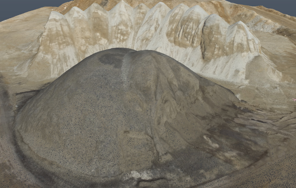
Drone mapping can be used to update clients on construction progress, analyze stockpiles of raw materials and create a 360° model. These in-depth updates allow clients to remain up to date on progress remotely and assists in important decision making. The technology provides clients a clearer view of a bigger picture.
-
Answers to Future Questions
Because laser scanning technology collects high quantities of data with ease, surveyors can archive information on record from the initial site visit. This eliminates excess traffic to take measurements at the site in the future and allows for questions to be addressed quickly.
-
Access to Difficult Areas
Sites that were once dangerous or impossible to survey can now be reached safely and effectively. Laser scanners can be used for small range-projects, such as viewing the interior of manholes, allowing for increased data collection and maintaining a safe work environment for surveyors. Sending a laser scanner into the manholes of the Hudson site resulted in collection of data including placement and measurement of sewage pipes that could not have been collected otherwise.
-
Minimize Unforeseen Consequences
Areas that are difficult or impossible to reach with traditional survey techniques such as busy roadways, flooded areas, hazardous sites, or congested city landscapes are ideal for drone technology. We can build a 3D model of underground utilities with increased accuracy to help minimize unforeseen consequences. Still relying on record plans and utility drawings with the assistance of 3D scans takes guess work out of the whole process.
Maximize Your Results Today
To learn more about this suite of technology and our slate of civil engineering and surveying services, contact us today.